
Services
- Drilling Services & tools rental
- Casing Running Services
- Fishing services.
- Gyro Survey services
- Coring and DST services
- Production services and equipment.
- Inspection and NDT services
- Safety Services.
- Training
- Manpower services and consultation
- ESP (Electrical Submersible Pump)
- Importing tools and Equipment
- Vessels and flow lines inspection and repairs
- Technical Engineering Services. (TES)
Key Objectives
Abraj Oil Services is capable to achieve these goals by following these key objectives: -
- Review and assess all available data such as geophysical interpretations, geological reports and maps, including petro physical studies and well log analysis, production data, pressure data, deliverability tests,…etc.
- Build a 3D geological model using all the Geological, Geo-statistical, Petro physical methodologies for a correct modeling of the reservoir static features and to determine the Original Oil in Place.
- Derive the 3-D Reservoir simulation model by means of up scaling techniques and Reservoir Engineering methodologies to obtain dynamic characteristics.
- Validate this model by matching the historical performance and to predict future production performance and reserves under different future production and development strategies.
- Identify the optimum future exploitation strategy to improve gas and oil production rates and reserves. The optimum plan will include all technical details for future drilling, completion, and production strategy, in addition to an economic evaluation of the optimum plan.


Our Team
Our team is able to:
- Articulate evaluation results in a clear and concise manner.
- Capable of handling all geological and reservoir responsibilities associated with drilling.
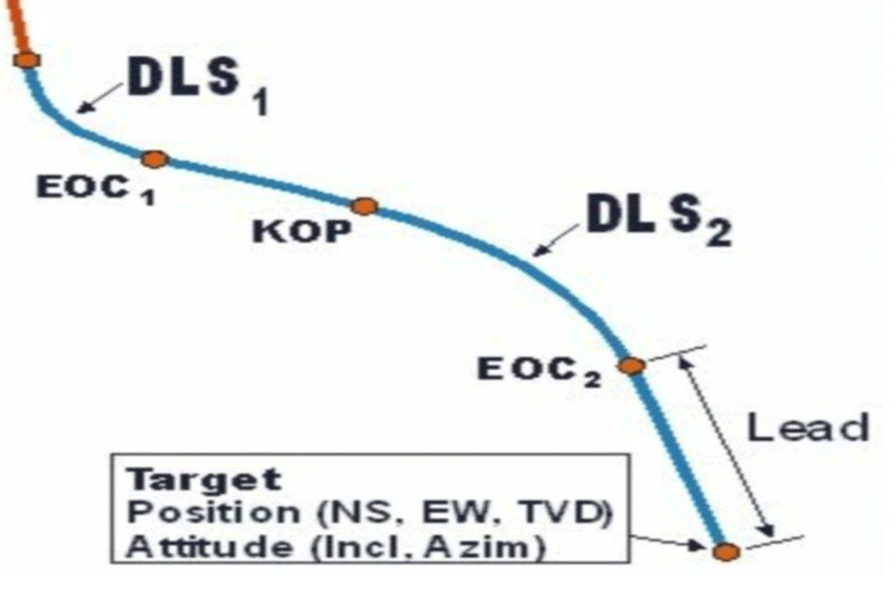
- Creates well targets data with reservoir and drilling engineers, and hence, generates well trajectories.
- Updates grids/maps in light of the new drilling information obtained from active wells to help optimizing wells objectives
- Perform the wells evaluations while and post-drilling, such as final correlations, maps and grids for both structural stratigraphic, and fluid limits mapping.
- Perform development geology studies that help in planning and modifications of operation plans.